LONG-TERM HABITAT CHANGES FROM THE 18TH CENTURY IN HUNGARY
INTRODUCTION | TREND DATABASE | STUDIED HABITATS | PILOT STUDY | KITAIBEL'S BOTANICAL DIARY(1796-1817) | DATA SOURCES AND USEFUL LINKS
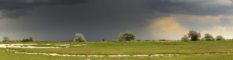
INTRODUCTION
The past is a reference not only for understanding the present landscape but for planning or predicting the future. Most studies on landscape change apply land-cover or land-use categories because the available sources of cartographical and remotely sensed material support this approach.
We analyzed long-term changes of 20 semi-natural forest, grassland, and wetland habitat types in 5000 randomly selected sample localities from 1783 to 2013 (Long-term changes of Natura 2000 habitat types). The country-wide habitat trend database (the Habitat Trend Database of Hungary) and its analysis support the management and conservation of valuable habitats, especially the priority habitats of the European Union (Natura 2000). Long-term trends of semi-natural, and secondary forest cover changes were also analyzed based on the Habitat Trend Database of Hungary.
The research was supported partly by the Swiss Contribution Program (SH/4/8), and by the projects of the National Research, Development and Innovation Office NKFIH K 131837 (“Fine-scale landscape ecology: linking vegetation change with interacting indirect and direct drivers using traditional ecological knowledge and oral history”), by the members of the Traditional Ecological Knowledge Research Group (Centre for Ecological Research).
INTRODUCTION | A TREND DATABASE | STUDIED HABITATS | PILOT STUDY | KITAIBEL'S BOTANICAL DIARY (1796-1817) | DATA SOURCES AND USEFUL LINKS
THE HABITAT TREND DATABASE OF HUNGARY
After the pilot study, we applied the developed method to 5000 random point localities in the whole area of Hungary. To describe temporal changes at each locality (center of grid cells), we assembled a long-term spatio-temporal point database. ArcGIS 10.1.ESRI software was used for managing datasets and maps and performing spatial analyses. We randomly selected the center of 5000 grid cells from the grid system (267 813 records ) of the MÉTA actual habitat database of Hungary. For choosing the studied time periods, we relied on cartographical sources broadly available covering large areas such as Military Surveys, Topographic Military Maps, and satellite images.
Cultural landscape types were also classified into habitat types following the National Habitat Classification System (Á-NÉR, Bölöni et al. 2011).
INTRODUCTION | TREND DATABASE | STUDIED HABITATS | PILOT STUDY | KITAIBEL'S BOTANICAL DIARY (1796-1817) | DATA SOURCES AND USEFUL LINKS
STUDIED HABITATS
Natura 2000 habitats
- 1530 - Pannonic salt steppes and salt marshes1530
- 3150 - Natural eutrophic lakes with Magnopotamion or Hydrocharition-type vegetation3150
- 6410 - Molinia meadows on calcareous soils6410
- 6440 - Alluvial meadows of river valleys of the Cnidion dubii6440
- 6210 - Semi-natural dry grasslands and scrubland facies on calcareous substrates6210
- 6240 - Sub-pannonic steppic grasslands6240
- 6250 - Pannonic loess steppic grasslands6250
- 9130 - Asperulo-Fagetum beech forests9130
- 91M0 - Pannonian-Balkanic turkey oak- sessile oak forests91M0
- 91G0 - Pannonic woods with Quercus petraea and Carpinus betulus91G0
- 91H0 - Pannonian woods with Quercus pubescens91H0
- 9180 - Tilio-Acerion forests of slopes, screes and ravines9180
- 91E0 - Alluvial forests with Alnus glutinosa and Fraxinus excelsior91E0
- 91F0 - Riparian mixed forests of Quercus robur along the great rivers91F0
- 91I0 - Euro-Siberian steppic woods with Quercus spp.91I0
- 91N0 - Pannonic inland sand dune thicket (Junipero-Populetum albae)91N0
Á-NÉR habitats
- D2 - Molinia meadows D2
- D34 – Mesotrophic wet meadows D34
- Ac – Euhydrophyte vegetation of naturally eutrophic and mesotrophic still waters AC
- B1a – Eu- and mesotrophic reed and Typha beds B1a
- B1b – Floating fens, oligotrophic reed and Typha beds of fens B1b
- F1a – Artemisia salt steppes F1a
- F1b – Achillea steppes on meadow solonetz F1b
- F2 – Salt meadows F2
- F3 – Tall-herb salt meadows and meadow-steppes F3
- F4 – Dense and tall Puccinellia swards F4
- F5 – Annual salt pioneer swards of steppes and lakes F5
- G1 - Open sand steppes G1
- H3a – Slope steppes on stony soils H3a
- H4 – Semi-dry grasslands, forest-steppe meadows H4
- H5a – Closed steppes on loess H5a
- H5b – Closed sand steppes H5b
- P2a – Wet and mesic pioneer scrub P2a
- P2b – Dry and semi-dry pioneer scrub P2b
- J2 – Swamp woodlands J2
- J4 – Riverine willow-poplar woodlands J4
- J5 – Riverine ash-alder woodlands J5
- J6 – Riverine oak-elm-ash woodlands J6
- K1a – Lowland oak-hornbeam woodlands K1a
- K2 – Sessile oak-hornbeam woodlands K2
- K5 – Beech woodlands K5
- K7a – Acidofrequent beech woodlands K7a
- K7b – Acidofrequent oak-hornbeam woodlands K7b
- L2a – Pannonian-Balcanic Quercus cerris-Quercus petraea woodlands L2a
- L2b – Quercus cerris-Quercus robur woodlands L2b
- L2x – Closed mixed steppic aok woodlands on loess L2x
- L5 – Closed lowland steppic oak woodlands L5
- M3 – Open salt steppic oak forests M3
- M4 – Open steppic oak forests on sand M4
- M5 – Poplar-juniper sand dune forests and thickets M5
- M2 – Open steppic oak forests on loess M2
- M1 – Quercus pubescens scrub M1
- L1 – Closed thermophilous Quercus pubescens woodlands L1
- P45 – Wood pastures and Castanea sativa woods P45

INTRODUCTION | TREND DATABASE | STUDIED HABITATS | PILOT STUDY | KITAIBEL'S BOTANICAL DIARY (1796-1817) | DATA SOURCES AND USEFUL LINKS
THE PILOT STUDY
A regional study (Biró et al. 2013) was carried out for testing the methods for a country-wide assessement (Biró et al. 2018). For the detection of habitat changes a 30 x 60 km study area was selected in the characteristic central part of the Danube–Tisza Interfluve. 360 localities from the centroids of MÉTA hexagons (Actual Habitat Database of Hungary) were selected.
For choosing the studied time periods, we relied on cartographical sources broadly available and cover large areas such as Military Surveys, Topographic Military Maps, and satellite images e.g. the I. and III. Military Surveys (1780s, 1870s-1880s, Hadtörténeti Múzeum Térképtára, Budapest, Arcanum Kft).
To describe temporal changes at each locality we assembled a spatio-temporal point database. Defining the exact locations of the localities had particular importance. The stable landscape elements (roads, railway lines, channels) helped this process in a retrospective way. Points falling on arable land, vineyards, orchards, built-in areas, or tree plantations on the historical maps were characterized by the land-cover types. Localities falling on natural or semi-natural landscapes were classified into habitat types following the National Habitat Classification System (Á-NÉR, Bölöni et al. 2011). For this classification, we used data on habitats and habitat qualities from the MÉTA actual habitat database, our own field data, and data from the actual habitat mapping of the Danube-Tisza Interfluve (Biró et al. 2006). ArcGIS 10.1.ESRI software was used for managing datasets and maps and performing spatial analyses.
The types studied were as follows (Á-NÉR Habitat codes, Natura2000 Habitat codes): open sand grassland (G1, 6260), closed sand steppe (H5b, 6260), poplar-juniper scrub (M5, 91N0), closed natural forest (M4, 91I0), mesotrophic wet meadow (D34, 6440), Molinia meadow (D2, 6410), uncharacteristic meadow (OB, mostly dried out, species-poor mesotrophic meadows), uncharacteristic dry grassland (OC, mostly secondary grasslands on sand), uncharacteristic dry grassland invaded by non-native trees (Robinia pseudacacia and Ailanthus altissima), marsh (B1a, B6, 1530). After the pilot study, we applied an improved identification method on 5000 random point localities in the whole area of Hungary.
INTRODUCTION | TREND DATABASE | STUDIED HABITATS | PILOT STUDY | KITAIBEL'S BOTANICAL DIARY (1796-1817) | DATA SOURCES AND USEFUL LINKS
KITAIBEL'S BOTANICAL DIARY (1796-1817)
It is essential to use historical sources of botany, forestry, and geography during the estimation of former habitat categories, among which Kitaibel’s travel diary stands out by data richness and accuracy at the turn of the 18-19th century (between 1796 and 1817).
By processing the botanical data found in the diary within the current boundaries of Hungary two databases were developed helping the localization of sites of the diary. ArcGIS 10.1 ESRI software was used to develop the two GIS databases. Our basic sources had been the three volumes of the printed version of the diaries (Gombocz 1945 Diaria itinerum P. Kitaibelii. I.- II. Verl. Ung. Naturhist. Museums, Bp. 1–476, 477–1005; Lőkös 2001 Diaria itinerum P. Kitaibelii III., Hung. Nat. Hist. Museum, Bp. 460 pp). Databases had been developed during a research project for assessing the long-term habitat changes of Hungary (Swiss Contribution Program, SH/4/8).
Routes of Pál Kitaibel’s journey have been reconstructed using the I. Military Survey (1782-85) showing the settlement and road system of that time. The database that can be displayed using any GIS software contains the interior tracks, the names, and the dates of all 22 journies. In cases of different possible routeways alternative tracks are also indicated.
Localities of Kitaibel’s plant species lists have been specified in a GIS point database. The table contains the number of species recorded, the description of the place (eg. 'im Walde'), the name and date of the journey, the two settlements belonging to the record (from where to where), the volume and page number of the diary, and the accuracy of localization (very precise, well localizable, approximate, uncertain). The database has records of more than 2400 point localities of species lists. To accomplish this work primarily the 1st and 2nd Military Surveys were used besides the diary.
INTRODUCTION | TREND DATABASE | STUDIED HABITATS | PILOT STUDY | KITAIBEL'S BOTANICAL DIARY (1796-1817) | DATA SOURCES AND USEFUL LINKS
DATA SOURCES AND USEFUL LINKS
Felhasznált térképi és távérzékelt források, kapcsolódó linkek
I. Katonai Felmérés (1782–85): HM Hadtörténeti Intézet és Múzeum Térképtára, Budapest. Digitális kiadás: Az Első Katonai Felmérés. Königreich Ungarn. Digitized Maps of the Habsburg Empire 1763–1785, DVD, Arcanum Adatbázis Kft., Budapest.
II. Katonai Felmérés (1829–66): HM Hadtörténeti Intézet és Múzeum Térképtára, Budapest. Digitális kiadás: A Második Katonai Felmérés. Königreich Ungarn. Digitized Maps of the Habsburg Empire 1806–1869, DVD, Arcanum Adatbázis Kft., Budapest.
III. Katonai Felmérés (1872–84): HM Hadtörténeti Intézet és Múzeum Térképtára, Budapest. Digitális kiadás: A Harmadik Katonai Felmérés. Königreich Ungarn. Digitized Maps of the Habsburg Empire 1869–1887, DVD, Arcanum Adatbázis Kft., Budapest.
IV. Háborús Katonai Felmérés 1940-42. Országos Hadtörténeti Múzeum Térképtára, Bp., Méretarány: 1: 50 000 In: Timár G. Molnár G. Székely B. Biszak S. Jankó A. (2008): Magyarország Topográfiai Térképei a Második Világháború időszakából (1940-42). DVD, HM Hadtörténeti Intézet és Múzeum Térképtár térképeinek digitális, georeferált kiadása, Arcanum Adatbázis Kft., Budapest.
Online történeti térképanyag, katonai felmérések, kéziratos térképek, kataszteri felmérések
http://arcanum.hu
http://maps.hungaricana.hu/hu/
http://mapire.eu
http://mapire.eu/hu/map/cad-pest/ &…;
http://mapire.eu/en/map/collection/firsts…;
http://mapire.eu/en/map/collection/second…;
http://mapire.eu/en/map/hkf_25e/
Pesty Frigyes Helynévtára:
Bereg Megye (1864-1865):
http://www.szabarchiv.hu/drupal/sites/def…
Bihar Vármegye (1865):
http://mnytud.arts.unideb.hu/sorozat/pest…;
http://mnytud.arts.unideb.hu/sorozat/pest…
Pest-Pilis-Solt-Kiskun vármegye (1864):
http://www.sulinet.hu/oroksegtar/data/meg…
Szabolcs-Szatmár-Bereg megye kéziratos térképei:
http://www.szabarchiv.hu/drupal/keziratos…;
http://archivportal.arcanum.hu/szabolcs/
Fényes Elek Geográfiai Szótára Komárom Vármegyéről:
http://www.sulinet.hu/oroksegtar/data/meg…
Bél Mátyás leírása Esztergom Vármegyéről
http://www.sulinet.hu/oroksegtar/data/meg…
Papíralapú térképek [1950-es évek 1: 25 000-es Újfelmérése (MHI TÉHI, Budapest), 1980-as évek 1: 25 000-es Gauss-Krüger térképezése (MHI TÉHI, Budapest), 1980-as évek 1: 10 000 EOV szelvények (FÖMI, Budapest)] és légifotóanyag (MHI TÉHI, Budapest)
1980-as évek Landsat TM műholdfelvételei (USGS, NASA, Interspect Kft.)
https://landsat.usgs.gov/about_landsat5.p…
1950-60-as évek légifotói
www.fentrol.hu
Magyarország ortofotofelvétele 2000 (FÖMI Budapest)
Magyarország tájértékeinek katasztere - TÉKA (FÖMI, Corvinus Egyetem)
http://tajertektar.hu/hu/
ESRI ArcGIS for desktop 10.0./online Imagery adatszolgáltatás
Jelenlegi és recens terepadatok
NÉBIH Archív üzemtervi adatok és erdőtérkép http://erdoterkep.nebih.gov.hu/
Gombocz E. 1945 Diaria itinerum Pauli Kitaibelii. I. és II. Verlag des Ungarischen Naturhistorischen Museums, Budapest. pp.: 1–476., 477–1005.
Lőkös L. 2001 Diaria itinerum Pauli Kitaibelii III. 1805–1817. Hungarian Natural History Museum, Budapest. 460 pp.
Biró M., Révész A. és mtsai. (2005): A Duna-Tisza köze aktuális élőhelytérképe, poligon változat, MTA ÖBKI, Vácrátót.
Biró Marianna, Révész András, Horváth Ferenc, Molnár Zsolt (2006): Point based mapping of the actual vegetation of a large area in Hungary - description, usability and limitation of the method. Acta Bot. Hung. 48 (3-4): 247-269. http://www.akademiai.com/doi/abs/10.1556/…
Biró Marianna, Szitár Katalin, Horváth Ferenc, Bagi István, Molnár Zsolt (2013): Detection of long-term landscape changes and trajectories in a Pannonian sand region: comparing land-cover and habitat-based approaches at two spatial scales. Community Ecology 14(2): 219-230. http://www.akademiai.com/doi/abs/10.1556/…
MÉTA Adatbázis: Molnár, Zs., Bartha, S., Seregélyes, T., Illyés, E., Botta-Dukát, Z., Tímár, G., Horváth, F., Révész, A., Kun, A., Bölöni, J., Biró, M., Bodonczi, L., Deák, J. Á., Fogarasi, P., Horváth, A., Isépy, I., Karas, L., Kecskés, F., Molnár, Cs., Ortmann-né Ajkai, A. and Rév, Sz. (2007): A grid-based, satellite-image supported, multi-attributed vegetation mapping method (MÉTA). – Folia Geobotanica 42: 225–247. http://link.springer.com/article/10.1007%…
The research was supported by the Swiss Contribution Program (SH/4/8) 'Assessment of the long-term habitat changes of Hungary' (MTA ÖK ÖBI).